Why is Israel-Gaza on Google Maps so hazy?
It's an issue that has been highlighted by researchers using open-source, publicly available information - including mapping data - to locate attacks and document the destruction.
"The fact that we don't get high-resolution satellite images from Israel and Palestinian territories sets us back," says Samir, an open-source investigator.
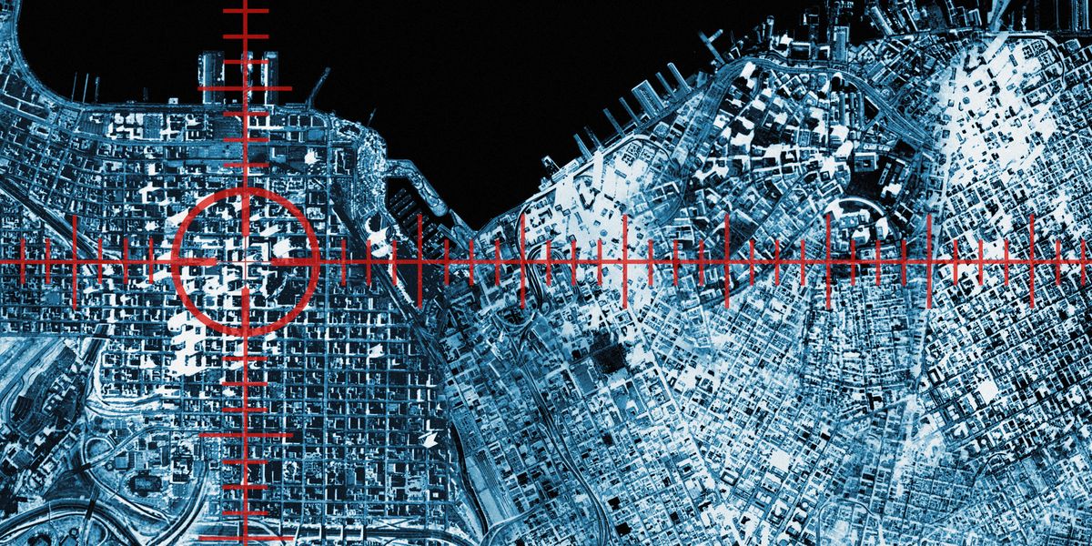
In fact, much of both Israel and the Palestinian territories appear on Google Earth as low-resolution satellite imagery, even though higher-quality images are available from satellite companies.
Compare that with Pyongyang, the secretive capital of North Korea, where the cars are sharply defined and it's possible to make out individual people.
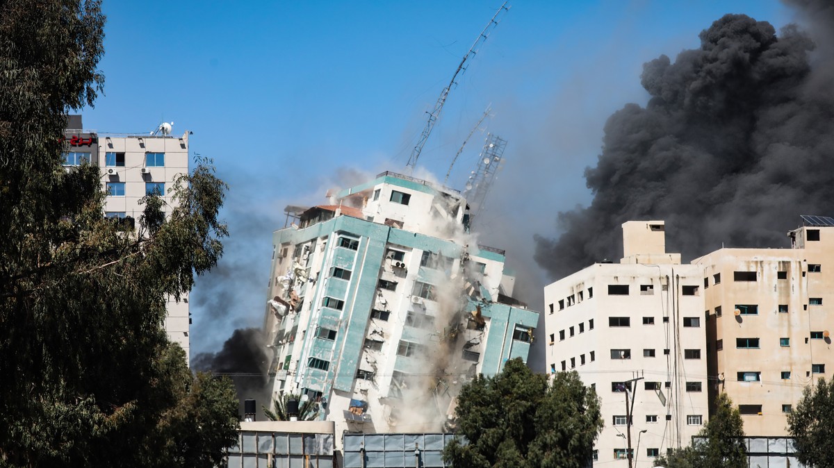
In the latest Middle East confrontation, investigators are looking to corroborate the locations of missile fire and targeted buildings in Gaza and Israel, using satellites.
However, on Google Earth, the most widely used image platform, the most recent imagery for Gaza is of low resolution and therefore blurry.
Leave a Comment
Related Posts


Recent Posts

About 1 in 4 US adults 50 and older who aren't yet retired expect to never retire, AARP study finds
Comment