How to serve custom maps for free with Leaflet and Cloudflare
or how to reinvent the wheel because I'm too lazy to read the docs
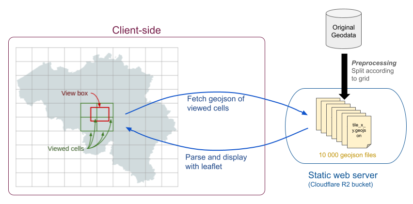
For a recent project, I wanted to create an interactive map containing information about every building in Belgium. I had done some simple maps in the past, but this was about 10 GB of geodata so I couldn't use my usual approach of putting all the data in a js file and making the client load everything at once: data would have to be fetch and shown on a need basis, as users would move around the map.
I started looking at hosted solutions like ArcGIS or Mapbox but I was quickly discouraged:
So I thought that I could maybe do it myself. I started to read about GIS servers, tile servers, vector tiles, etc. Serving maps is a super common problem, so of course very smart people have made incredibly powerful tools for every step you need. There are standards to make everything interoperable and open source frameworks that make everything fast and robust. The problem is, it is still a lot to learn, and I’m very lazy.


