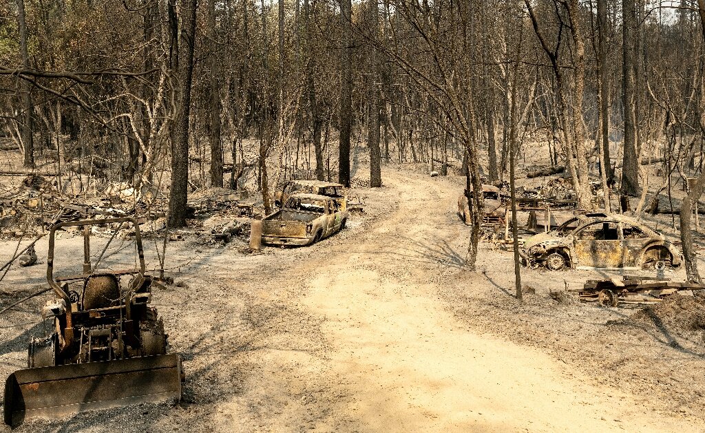
Before-and-after images show Helene wiped parts of North Carolina off the map
New before-and-after aerial photos paint a grim picture of Hurricane Helene’s devastation in parts of western North Carolina that have been hard to access after the storm swiped away the state’s roads and bridges.
The monstrously sized Category 4 hurricane carved a more than 500-mile path of destruction across the Southeast and has killed more than 200 people – the second-deadliest hurricane to strike the US mainland in the past 50 years.
Many of those deaths are in North Carolina, where the storm’s hallmark was prolific rainfall and historic and catastrophic flooding.
The storm threw down so much water over the southern Appalachians over a 3-day span that it was a widespread once-in-1,000 year rainfall event for the region, according the National Weather Service.
All of that water barreled down the mountains, liquifying the slopes in some places into devastating mudslides that wiped homes off their foundations. But eventually, it all ended up in rivers.


/cdn.vox-cdn.com/uploads/chorus_asset/file/25656241/spotifybackup1.jpg)