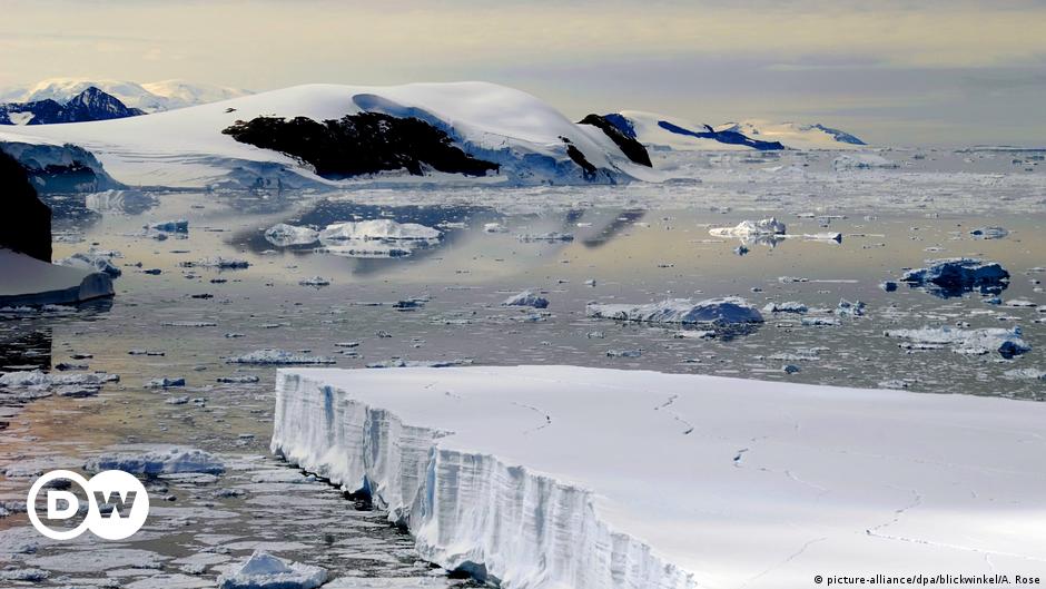
The frozen continent without ice: New Topography of Antarctica
One of the earth’s most alien landmasses, the Antarctic’s rocky surface, concealed by a vertical ice crust of up to more than 3km (average thickness 1,6km), was unveiled, at least digitally, at an unprecedented detail in spring 2013. Scientists have created a significantly improved map of the continent’s bedrock in the frame of the bedmap2 project led by the British Antarctic Survey. While the previous version ‘bedmap’, produced in 2001, gave a general overview of the Antarctic’s topography, the high spatial resolution of bedmap2 shows a landscape of mountain ranges, hills and vast plateaus dissected by canyons and gorges. Thus, it conveys the cartography of the bedrock terrain much closer to reality than ever portrayed. The project was prompted by the motivation to calculate the total extension and mass of ice that occurs in the Antarctic, which is essential to estimate the sea level rise induced by the melting of the polar ice. Therefore, the shape and structure of bedrock beneath the ice sheet was needed to know in detail. Bedmap2 relies on information from NASA’s IceSAT1 satellite (Cloud and Land Elevation Satellite) gathered between 2003 and 2009 and ice thickness data from the airborne based Operation IceBridge (radio echo sounding measurements, seismic techniques as well as satellite and cartographic data).
The new level of measurements delivers important information on variables that are of interest for research, particularly climate related study due to the key role of the Antarctic in this matter. Some new facts are: